Waypoints: the route goes where you choose
A route around the wrong side of a cape is no use to you. Waypoints dropped on the map make every route pass where you decide.
A router weighs the wind and the current; it knows nothing of what you know about the coast. It may send you outside the reefs west of the Ile de Sein when you mean to take the Raz, leave an island on the side you want to avoid, or give up on a passage longer than it can search, from Brittany to the Mediterranean by Gibraltar. The fastest route on paper is not always the one you would sail.
Right-click or long-press the map: beside the departure and the destination, the menu offers Add a waypoint here. Every model's route then passes through it on its way to the destination, and through the next one if you add more. A waypoint falls on the leg it lengthens the least, takes its row in the trip between the departure and the destination, named after the nearest place, and can be dragged, passed earlier or later, or removed. Waypoints are open to every visitor, with or without an account.
Each leg is computed as a route of its own, leaving from where and when the boat reached the waypoint before: on the second leg, the wind and the current are those of the hour you actually get there, not of the hour you left. A detour no single route could make thus becomes possible, the Bay of Biscay to the French Riviera by Gibraltar included. Up to ten waypoints per trip; only the models covering every one of them compute it, and a waypoint dropped on land or on a shoal is moved to the nearest navigable water, if there is some within 2 NM.
Say you sail from Lorient to Brest. Left to itself, every model may stand off outside the reefs west of the Ile de Sein. Drop a waypoint in the Raz: the routes now go through it, and the time cursor tells the hour each one reaches it. Move the departure until that hour falls when the tide turns in your favour, then compare with the routing outside, without the waypoint: you choose the way knowing what each one costs in hours, and when each one gets you there.
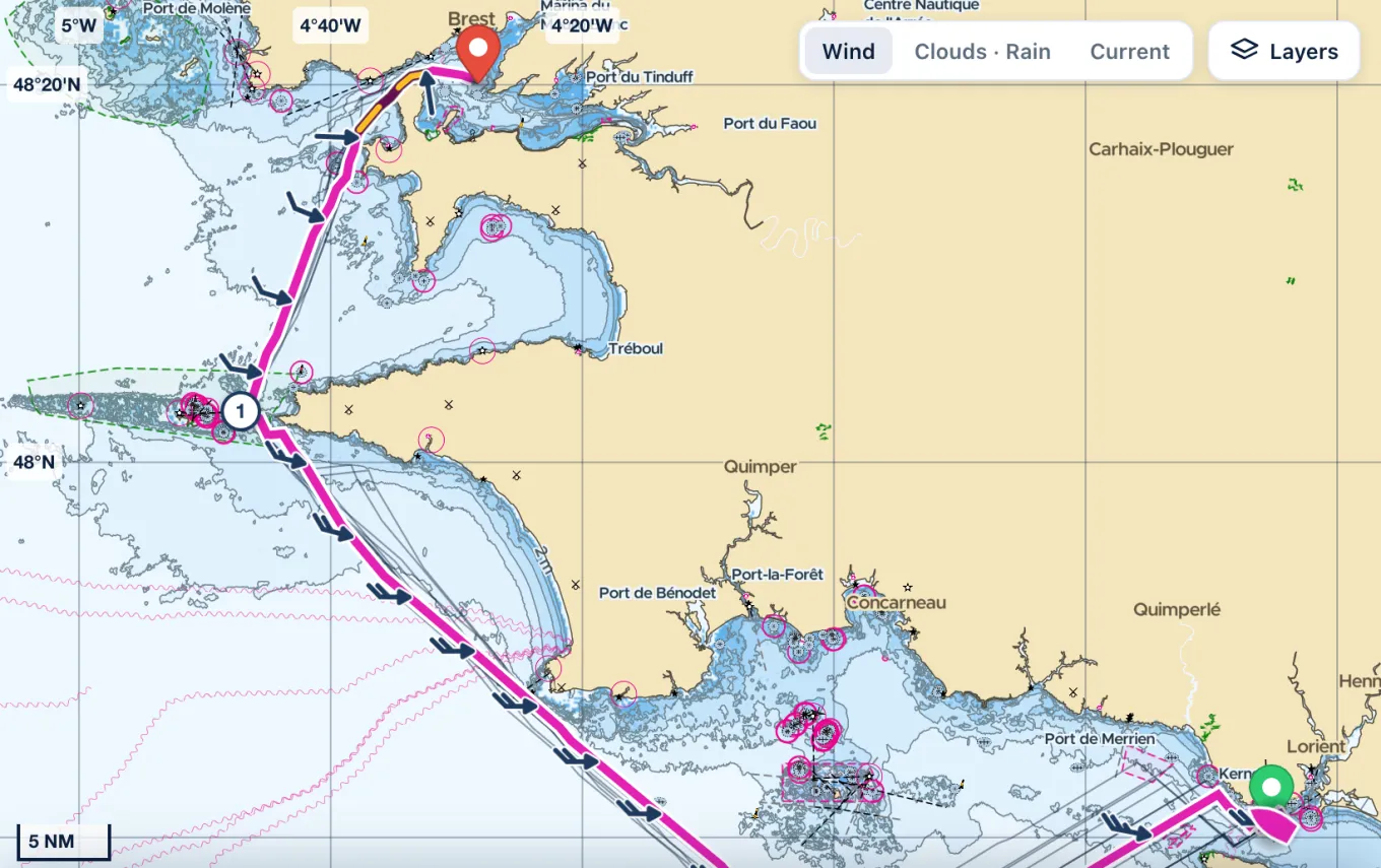
A waypoint is a point to pass, not a port of call: the route leaves it the moment it reaches it, so a night at anchor is two routings. It counts as reached within the arrival distance, like a destination, near it rather than on it: never drop it on the rock you mean to clear, but in open water on the side you want. And in a race as narrow and fast as the Raz, take the forecast current as a guide: the tidal atlas and the pilot book have the last word on the hour to pass.