Sun, moon and nights along the route
How dark will the night be out there? Every route now tells when the sun and the moon rise and set, and how dark each night will be.
In autumn, a passage of a day or more is half night. And no two nights are alike: under a high, full moon you see the horizon, the sails and the next squall coming; on a moonless night after dusk you see nothing but lights, the sea comes out of the black and a watch feels twice as long. Sailors look up the sunset, the moonrise and the phase in an almanac, then work out where the boat will be by then. A route told the wind hour by hour, and left the night to you.
Every route now tells the sky over the boat, wherever she is at each hour. The route log, and the list of legs beside the map, give each sunset, sunrise, moonrise and moonset under the leg sailed at the time, and in the route log each night has its own line: how much of the moon is lit, whether it is waxing or waning, and when the night is dark, faint or clear. The charts shade the nights, darker the darker the night, and the map dims at the time cursor once night falls where the boat is, a badge giving the moon's phase and height and how dark the night is.
A night is dark once nautical twilight has ended, the sun 12° below the horizon, while the moon is down or less than 25 % lit; it is clear under a moon more than 60 % lit and well above the horizon; faint in between, twilight included. The clouds count too: when the model covers six eighths of the sky or more, the moon is hidden and the night counted as moonless; three to five eighths veil it, and a clear night turns faint. Every wind model but NOAA AIGFS, DWD AICON and HARMONIE DINI gives its cloud cover. It is all open to every visitor, with or without an account, on the site and in the apps.
Say you cross from Nice to Calvi overnight in mid-November, under a waxing moon not yet half lit. Under a clear sky, the route tells a faint night while the moon is up, then a dark one from moonset, before midnight, until dawn; under the overcast of a passing low, a dark night from nautical dusk. Either way, the landfall on Corsica comes in the black, in the hours when you see the least. You can set the watches so that two of you are on deck through the dark hours, leave a few hours later to make the landfall after sunrise, or wait a week for a moon nearly full that lights most of the crossing, the sky permitting.
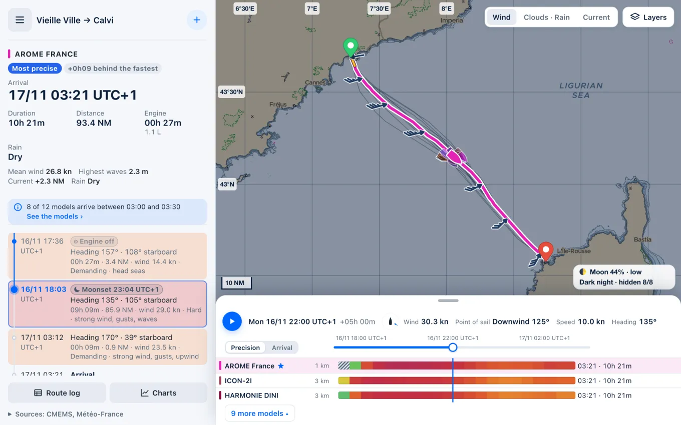
The sky is shown only: it never changes the route, computed on the wind and the current as before. The clouds are the model's, a mean over its grid cell: a sky forecast clear may still cloud over, and a thick cover may break. Rises and sets are given to within a couple of minutes, over a sea horizon that a mountainous coast will raise. And a night dark by the moon can be lit by a town's glow, or darker still under rain: read the night to plan the watches and the landfall, and keep a good lookout whatever the badge says.
Sources
- Rise, Set, and Twilight Definitions, U.S. Naval Observatory
- Twilight, Wikipedia
- Lunar phase, Wikipedia