Rain and clouds along the route
Where will it rain as you sail, and how hard? The map now shows the forecast rain over its clouds, and every route the rain it meets.
A wind forecast tells you how fast the boat will go, not how wet the watch will be. Yet the rain changes a passage too: the band of a front that comes with a wind shift and falling visibility, the squall that drops out of a grey sky with its gusts, the night of drizzle that wears a short-handed crew down long before the wind does. Until now, a route told the wind hour by hour and left the rain to another app.
The map's Clouds · Rain button now shows the rain the model forecasts, in millimetres an hour, coloured as on a weather radar and moving with the time cursor, the route drawn over it. Beneath the rain, a grey veil shows the cloud cover, in eighths of the sky, thicker as it closes in. And every route tells its own rain: the summary gives the hours sailed in rain and the heaviest rate, the route log grades each leg's rain light, moderate or heavy (under 2.5 mm/h, under 7.6 mm/h, above), heavy rain making the leg demanding, and a chart draws it along the passage.
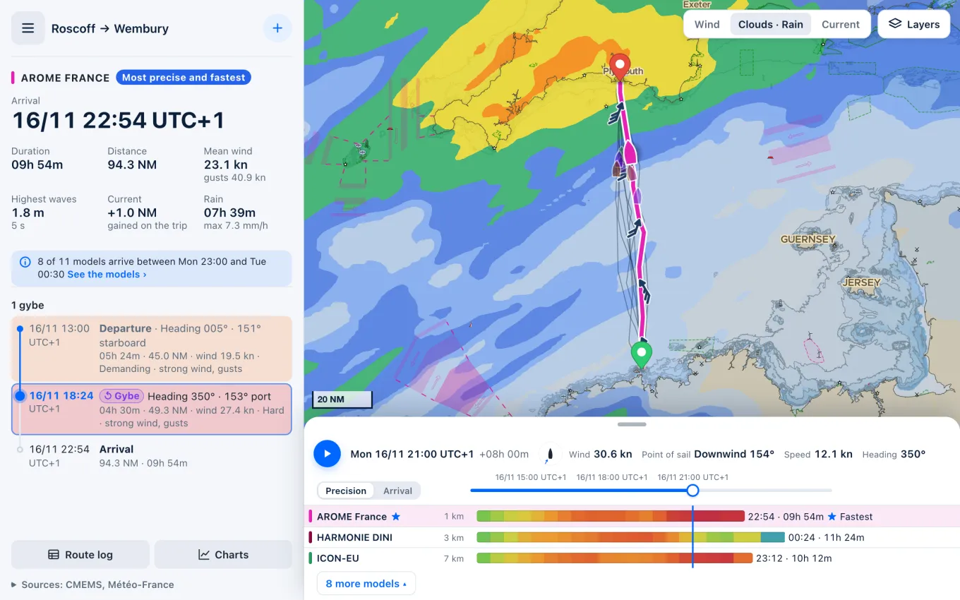
Every wind model gives its rain, read in the same run as the route's wind, so that each model's route meets its own showers; all but NOAA AIGFS, DWD AICON and HARMONIE DINI give their clouds too. The rain is there for everyone, with or without an account, on the site and in the apps, where a kept routing holds offline the rain and clouds downloaded with it, readable once the signal is gone.
Say you plan to cross the Channel from Roscoff to Plymouth as a cold front comes in from the west. The routes show where its band of rain meets them: over the last miles, after dark, the rain growing heavier as Plymouth Sound draws near. You can leave in the small hours to be in before it, double the watch for the landfall, or simply have the oilskins on and the reef in before it arrives, rather than looking for a harbour entrance at night in heavy rain.
The rain is shown only: it never changes the route, computed on the wind and the current as before. A model's rain is a mean over its grid cell and over an hour or more: a shower is smaller and shorter than that, and can pop up anywhere, so a dry route does not promise a dry sky under a towering cumulus, and a heavy hour may fall a few miles off. Outside a model's area the map shows nothing, which is not dry weather. Read the rain as where and when to expect it, and keep an eye on the sky and, near the coast, on the radar.