A nautical chart of the world, from OpenStreetMap
Buoys, lights, rocks and traffic separation schemes now lie under the routes the world over, from OpenStreetMap: a chart to prepare with, not to navigate by.
A route drawn on a blank sea answers only half the question. Once past the open water, what matters is what lies along the line: the cardinal marks to leave on the right side, the light that will rise at landfall, the traffic separation scheme to cross at right angles, the rocks the depths only hint at. Until now, that meant opening another chart, on another screen, and finding the same waters again.
The routing map now carries a nautical chart: buoys and beacons, lights with their characteristics and sectors, traffic separation schemes, rocks, wrecks and obstructions, cables and restricted areas, laid over the depths and under the routes. It is drawn from OpenStreetMap, where volunteers map the seamarks with a scheme modelled on the hydrographic offices' own standard, the work OpenSeaMap began in 2009. The map itself takes a chart's colours: buff land and a pale sea in the light theme, a midnight-blue sea in the dark one.
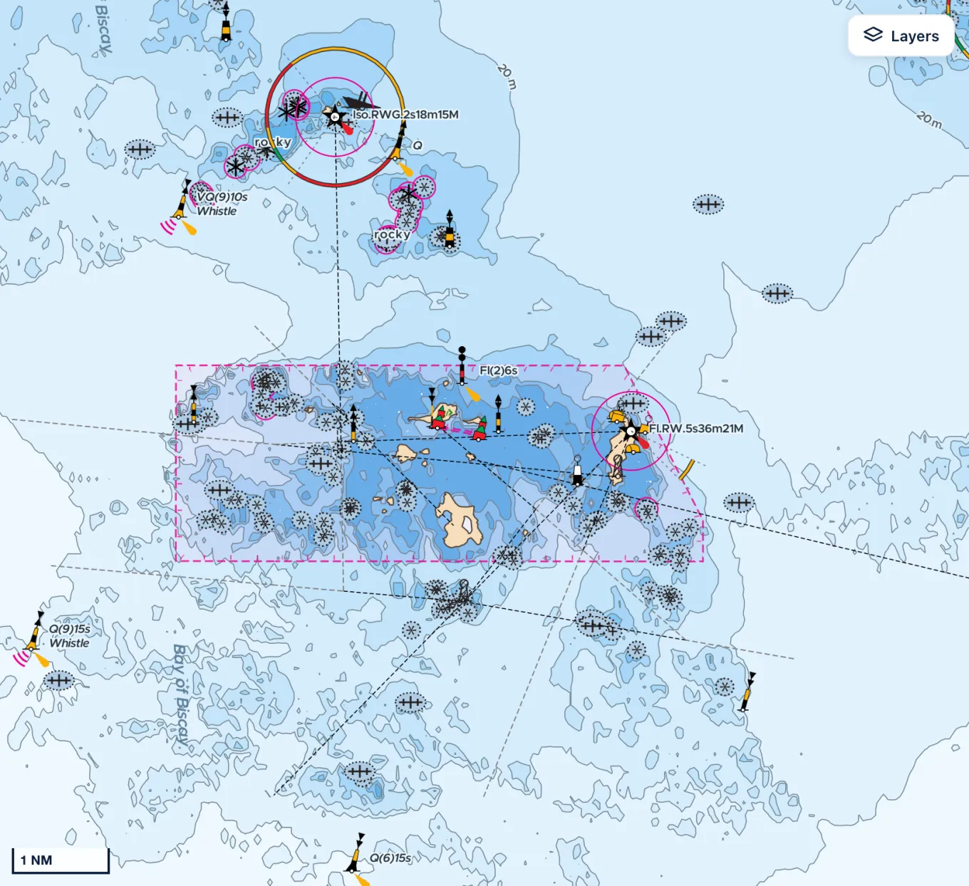
It covers the whole world, as thoroughly as its contributors have mapped it: some coasts are charted mark by mark, others hardly at all. It shows from the first visit and can be hidden from the Layers menu. The harbours, anchorages, buoys, beacons and lights it names are also found by their name in the Find a place field, so that a mark read in a pilot book takes the map straight to it, if the chart spells it the same way.
Say you leave Concarneau for the Glénan on an autumn afternoon, and the route has you arriving at dusk. On the chart, the last miles thread between rocks and cardinal marks, within sight of the lights of Les Moutons and Penfret. You see it before you cast off, not on arrival: you may leave an hour earlier to come in by daylight, and you know which marks and which lights to look for.
This is not a chart to navigate by. Its marks are entered by volunteers and refreshed with the basemap by hand: one may be missing, misplaced or months out of date. The route still ignores the marks, avoiding only the land and the shallows. The chart needs a connection, too: offline, in the apps, it is gone. Prepare with it; sail with the official chart and the latest notices to mariners.
Sources
- OpenSeaMap, OpenStreetMap Wiki
- Seamark Tagging Schema, OpenStreetMap Wiki
- About OpenStreetMap, OpenStreetMap Foundation