The first route, drawn by isochrones
Which way gets you there soonest, with the wind to come? Saily WR's first route answered it, drawn by isochrones on the GFS forecast.
Before a passage, every skipper asks the same question: with the wind to come, which way gets me there soonest? Answering it by hand means reading a forecast hour by hour, the boat's polar in mind, and guessing where to tack or gybe. It is slow, and the best way is rarely the obvious one.
Saily WR answers it with the isochrone method. From the departure, the boat sets off on every heading at once, at the speed its polar gives for the wind it meets; the points it could reach after each time step form a line, the isochrone. Step after step, the lines spread out until one of them touches the destination, and tracing back from that point gives the fastest route.
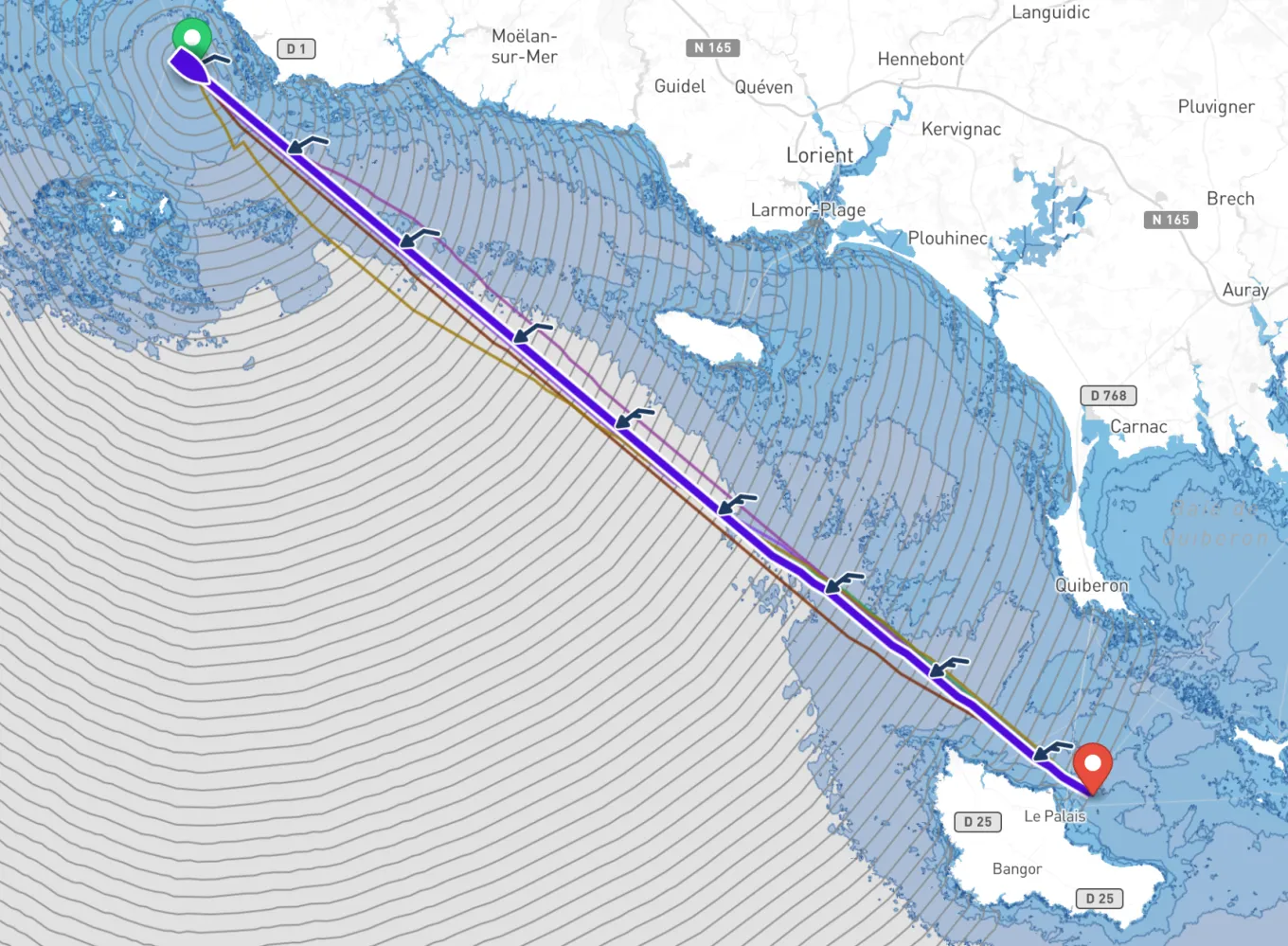
This first version read a single model, NOAA's GFS, which forecasts the wind over the whole world up to sixteen days ahead, and drew the route on a map where two clicks placed the departure and the destination. A day sail across the bay or a fortnight's ocean crossing: the question is the same, and so is the method.
It earns its keep where the obvious way is the wrong one. Beating to a harbour upwind, with the wind due to veer in the afternoon, which tack first? The isochrones try both, and every heading in between, and the route shows which side pays and roughly when to go about. Change the departure time, and you see whether leaving at dawn or after lunch gets you in sooner, before you have even cast off.
A route is only as good as what it rests on. It sails in the forecast's wind, and if the forecast is wrong, so is the route; it trusts the polar, which few boats match to the knot. It knows nothing of the sea state, the crew's fatigue or the shipping lanes: it is the first line of a passage plan, and the call is still the skipper's.
Sources
- Practical Weather Routing of Sail-assisted Motor Vessels, H. Hagiwara and J. A. Spaans, The Journal of Navigation, 1987
- Global Forecast System (GFS), NOAA