Keeping off the shallows
A coastline says where the land is, not where the water runs thin: routes now keep to water as deep as you choose, on GEBCO and EMODnet.
A coastline tells where the land is, not where the water gets too thin. A bank a mile offshore, a rock head in the middle of a bay: a route that only avoids the land sails straight over them, and the first you hear of it is from the echo sounder.
Routes now keep to water at least as deep as the minimum depth you set, 10 m by default: your draught plus a safety margin. A departure or an arrival placed in water too shallow, in a harbour or on a shoal, is moved to the nearest water deep enough, 2 NM away at most, and the summary says how far.
The depths come from GEBCO for the whole world, and from EMODnet, about four times finer, in Europe and the eastern Caribbean, from eastern Hispaniola to the Lesser Antilles. There, the shallowest depth of each cell counts, so that a rock head is not lost in an average, and a bank that dries at low water counts as land: no route crosses it, even at high tide. With depths this fine, avoiding the shallows became the default; the OpenStreetMap coastline stays the other choice, for when every islet and channel matters more than the depth.
Take the Raz de Sein, between the Pointe du Raz and the island of Sein, whose shallows stretch far out to the west. The route keeps to the deep water between the two, and the routing map shows the same depths, with the isobaths from 2 to 50 m: you see why it swings wide of a bank before you get there. With a heavy swell running, raise the minimum depth and the route stands further off the shallows; on a calm day, bring it down towards your draught and its margin, and it may find a shorter way. But in the Raz, the tide decides the hour more than the depth does: time it with the stream.
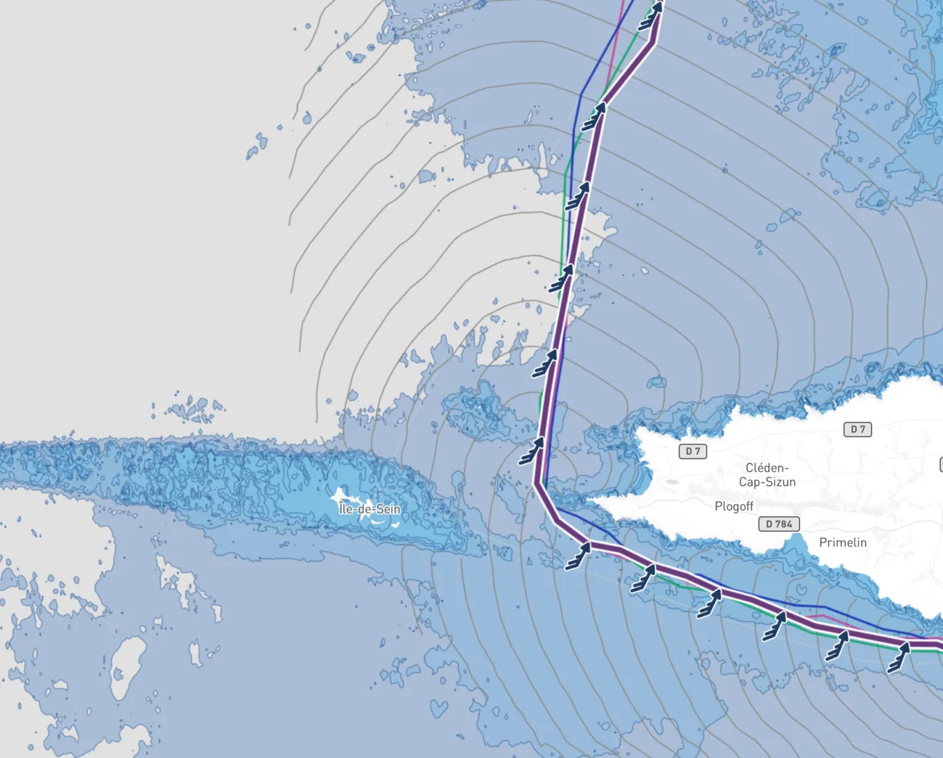
The tide is not added, though. Where EMODnet measures them, in Europe and the eastern Caribbean, depths are from chart datum, the level of the lowest tides; elsewhere they are from mean sea level, and at low tide there is less water than that. GEBCO's coarser grid may also show a small harbour as closed. And the route follows the depths, not the buoys or the marked channels: like any chart of this kind, this one is not for navigation.
Sources
- GEBCO, General Bathymetric Chart of the Oceans, IHO and IOC of UNESCO
- Bathymetry, EMODnet
- EMODnet Digital Bathymetry (DTM 2024), EMODnet Bathymetry Consortium